For energy organizations managing decades of exploration and production information, better searchability means less time hunting for records and a clearer view of what’s available for the work ahead.
Why Well Files and Seismic Data Are So Hard to Find
Energy organizations generate and rely on large volumes of physical and digital information, and these collections can span offices, field locations, storage facilities, legacy archives, spreadsheets, shared drives, and disconnected systems.
Imagine that you’re preparing for an asset review when someone asks for the records tied to an older well. You start with the shared drive, but the well is listed under a former operator. A spreadsheet points to a box in storage. The completion report is a scanned PDF, the log uses a service-company file name, and the seismic data sits in a legacy system under an old survey code.
What should take a few minutes becomes a trail of emails, cross-checking, and guesswork. Even after you find a record, you aren’t sure whether it’s the latest version, if supporting maps or reports are stored elsewhere, or how to request the core, sample, or tape tied to it.
The information exists, but the details that help you find, connect, and use it are scattered.
What It Means to Make Energy Records Searchable
A well file or seismic dataset is searchable when people can find it using the terms they already know:
- Well name, API/UWI, field, basin, operator, or location
- Survey name, line, 2D/3D type, acquisition year, or processing version
- Log type, formation, depth, report title, or keyword
- Related physical assets such as cores, samples, maps, or tapes
Storage provides a location for the asset to “live”, but not necessarily a usable search path. Records also need useful descriptions, indexed content, links to related material, and a clear retrieval process. Those elements let a user move from an asset or location to the records that support it.
To make well files and seismic data searchable—and therefore usable—start with a working inventory, capture the metadata your teams use, index the content inside files, add location context, link related records, and make retrieval part of the process. With that structure in place, users can search by well, API/UWI, survey, field, location, or document content instead of relying on file names or separate spreadsheets.
Consider the following 5 steps to create a searchable information environment for your organization and move your program beyond storage:
Step 1: Start With a Scoped Inventory
Before a project to improve records’ findability starts, you’ll need to establish a clear view of what exists.
That doesn’t mean scanning every document, converting every legacy file, or attempting to organize an entire collection at once. Instead, start with by identifying the collections that matter most to current operations, projects, and decisions.
A scoped inventory creates a reliable view of what exists, where it lives, what format it’s in, and which assets it supports. The inventory should answer a few basic questions:
- Which records do teams use most often?
- Which physical and digital materials relate to the same asset?
- Where are there gaps, duplicates, or incomplete descriptions?
- What should become searchable first?
These answers create a practical starting point for prioritizing digitization, indexing, storage, and retrieval work. It also exposes gaps and duplicates early—if several collections contain information about the same well or survey, the organization can determine how those records relate before investing time in processing them.
Step 2: Capture Metadata That Matches How Teams Search
Metadata works best when it reflects the questions people ask when they’re working.
For example, a geoscientist may want to know whether gamma ray logs exist for a particular field. An asset team may need to identify every 3D survey covering a lease area. An operations team may need a report associated with a specific well. The metadata model should support those searches without requiring an internal file name or storage code.
The right metadata standard will vary by organization; the important point is to build it around the way your teams work with the information.
Legacy EHR Archive Readiness Workbook
Before you shut down a legacy EHR, test the archive the way your team will use it after decommissioning. Can authorized users find the right record, confirm it is complete, and show how it was retrieved and produced? Use the…
Step 3: Index File Contents and Relationships
File names provide a starting point, but useful context often sits inside the file. PDFs, Word documents, spreadsheets, TIFFs, scanned reports, maps, and images may contain technical details that users need to find.
Optical character recognition, or OCR, makes the text in scanned records searchable, so a user can find a report based on keywords mentioned within the document. Text extraction can do the same for digital files.
Finding the file is only part of the job. Users also need to understand what it relates to and which records belong with it. A well file, log, core report, map, seismic line, and physical sample may sit in different places but support the same asset. Linking them helps teams find related material and spot missing information without comparing several inventories by hand.
Step 4: Add Location and Map Context
Energy data has a strong spatial component. Users may search by basin, field, well location, lease, survey footprint, or radius, especially when they know the area but not the exact asset name or identifier.
A map-based view gives users another way into the collection and can show which records relate to the same area. However, useful results depend on consistent location data. Variations in coordinates, naming conventions, or geographic references can separate records that belong together, so standardizing those fields should be part of the indexing work.
Step 5: Build Retrieval Into the Search Workflow
Building a solid search structure is useful only if your team can act on what it finds. Depending on the record, that action might involve reviewing a digital document, retrieving a scan, requesting a physical file, locating a core or sample, or confirming where legacy media sits in storage.
These abilities become especially important when an organization maintains both physical and digital collections. Digitizing frequently used materials improves access, while secure offsite storage provides an appropriate home for records that require physical retention. That means the search workflow should consider whether a record exists digitally, where a physical item resides, and what steps are available to retrieve the information.
This approach reduces the amount of time employees spend tracking down records across disconnected systems and storage locations, making your data function as one cohesive body of information.
Searchability Starts With Better Information Access
Making well files and seismic data searchable starts with knowing what exists and continues through the way records are described, indexed, connected to assets and locations, and delivered when someone needs them.
A practical plan begins with the collections that support current work. Teams can then improve metadata, index hidden content, connect related records, add location context, and define a retrieval path for each format. This makes search less dependent on file names, separate spreadsheets, or the knowledge of a few long-time employees.
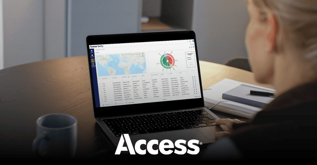
Access gives energy organizations a way to put that approach into practice across physical and digital collections by combining physical custody, digitization, indexing, retrieval, and ongoing support. Access Unify® | Energy serves as the interface, helping teams search for and request the material they need.
See how Access Unify | Energy can help make your records easier to find and retrieve






Share